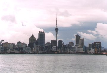
The skyline from Auckland as seen from the ferry from Devonport.
|
The skyline from Auckland as seen from the ferry from Devonport. |
It's pouring when we land at Auckland Airport. This is not what we expected. Apparently summer in New Zealand doesn't necessarily mean beautiful weather. Fortunately it's only a shower and soon the sun breaks through the clouds. After a lot of formalities (immigration, customs, Otago Campervans) we're finally en route. Our destination is Takapuna Beach, a small village about 10 km north of Auckland where we will camp for the night. Driving on the left in an unfamiliar car through downtown Auckland in, again, a heavy downpour is strenuous. But we safely reach the campsite. We quickly set up our tent, a small 2-person hiker's tent, and than head for Devonport, an attractive suburb on the tip of Auckland's North Shore peninsula. From there we take the Devonport Ferry to Auckland. The crossing takes about 15 minutes and offers us a nice view on Auckland's skyline with the 328 m Skytower being the most notable building. |
| Auckland, or Tamaki-Makaurau as the Maori call it, is New Zealand's largest city. Its earliest settlements date back to as far as 1350 AD. Nowadays approximately 1 million people live in the suburban sprawl that stretches almost 60 km north to south and 30 east to west. We restrict ourselves to the Auckland City Center where we spend a few hours walking. From the waterfront, where the latest developments in the America's Cup 2000 can be followed, we walk trough Queen Street up to the Auckland Domain. From there we go back again through Parnell. Parnell, an old inner suburb, consisting of a number of restored shops and houses. Although it's a pleasant area, it isn't the interesting area that we expected judging from the tourist's info. Via the Auckland University grounds we reach the Skytower, today's last destination. |
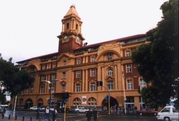 The Ferry Building where the ferries from Devonport and the Gulf Islands arrive. |
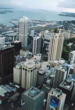 Downtown Auckland as seen from the Skytower. |
The Skytower, situated on the corner of Federal and Victoria Streets, is New Zealand's tallest building. With a height of 328 meters it's dominating the skyline of Auckland. The Skytower has four observation decks of which the Sky Deck is the highest. Of course we take the elevator to the highest deck to admire Auckland and its surroundings. To the east we see downtown Auckland with its high-rise buildings. The north shows us the harbour with, in the distance, Devonport. In the west the Harbour Bridge over Waitemata Harbour is clearly visible, as is America's Cup village, a temporary village to house The America's Cup 2000 yachts, crew, press and other people. The south is the least interesting with only suburbs. The views are impressive and while we enjoy the scenery darkness sets in. Slowly Auckland transforms itself into a sea of light, a sight even more impressive. Unfortunately a fog starts obscuring our view and after a while we go down. To our surprise the fog only covers the upper observation deck. On the lower observation decks the views remain clear. However, the flight from Hong Kong and the 5 hours time difference starts to take its toll and we decide to return to the campsite. |
A pleasant walk brings us back to the waterfront. From there we take the ferry
back to Devonport. Again, but now in the darkness, we enjoy the skyline of Auckland,
bathing in light now. Finding the campsite again is not so easy as we thought
and it takes some time before we reach the tent. Longing for a good night's
rest we discover that our tent is not really waterproof. A shower earlier that
day has soaked our mattresses. There's only one solution left: we have to sleep
in the car tonight. However, we're tired enough and quickly fall into a deep
sleep dreaming of the Skytower by night.
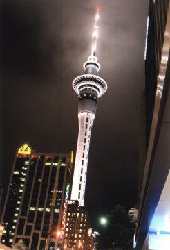
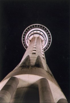
Auckland's Skytower in its full glory. |
 Orbit, the Skytower's revolving restaurant as seen from below. |
![]()
![]()